| |
| |
| |
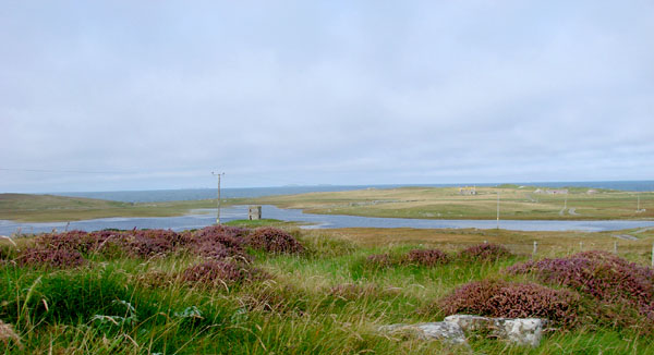
| From
Uig to Lochmaddy in North Uist is a journey of a little
less than two hours by ferry. The island is a mix of
broad beaches, freshwater lochs and machair,
interrupted by rolling hills. Machair is raised
beach land, left high and dry by rising sea levels.
It is mainly ground shell and as such is very fertile.
The ecosystem is unique and very delicate with rare
carpet flowers and a diverse array of birds. |
| |
|
Lochmaddy
(Loch nam Madadh) |
|
|
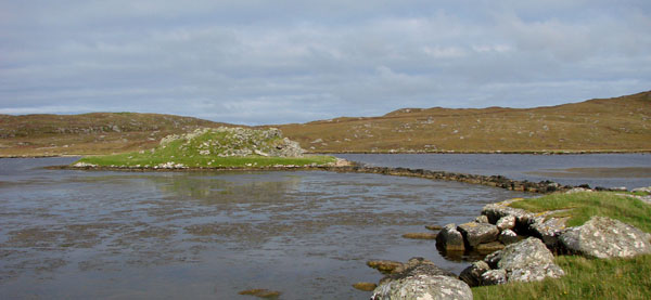
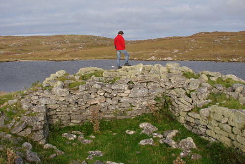
| After
the ferry docked we headed north to Berneray, stopping
along the way to visit Dun an Sticir, an Iron Age stronghold
occupying two islands connected by stone-built causeways.
During the Middle Ages a rectangular hall was inserted
into the circular structure. |
| |
|
Dun
an Sticir & Causeway
|
| |
|
Roddie
at Dun an Sticir |
| |
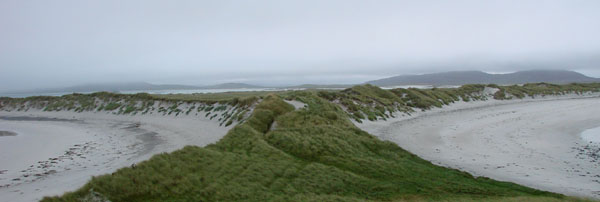
September
7
The
next day started out with a walk along the beach (or
rather beaches) on the north coast. It was a moody
day and the dunes and machair were spectacular. |
| |
|
Velish
Point |
| |
|
Scolpaig
Tower, a folly |
| |
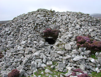
| The
prehistoric antiquities on North Uist include a number
of Neolithic chamber tombs, standing stones and stone
circles along with brochs and houses of Iron Age date.
The most accessible is the cairn of Barpa Langas on
a hill slope. It is a roughly circular mound of small
rocks a little over 4 metres high and about 24 metres
in diameter. The entrance is to the east leading to
a tomb chamber with a number of stone pillars to support
the roof. |
| |
|
Barpa
Langas. Entrance |
Barpa
Langas. Exporing the interior |
|
| |
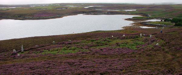
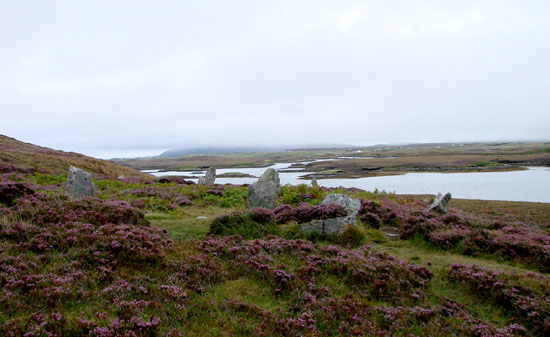
| The
stone
circle (it is actually more of an ellipse) is a short
distance away, behind the modern lodge and overlooking
Loch Langass. There were originally about 40 stones
altogether but only 20 are still standing. The name
translates as the “People of Finn” (Fionn
MacCumhaill or Finn McCool), the mythical hunter
and warrior of Irish legend). |
| |
|
Pobull
Fhinn Stone Circle |
| |
|
Pobull
Fhinn Stone Circle |
| |
| Back
to the hotel for some Ardbeg and a lovely meal at the
Tigh Dearg Hotel. |
| |
September
8
The
next day we drove over the causeways to Benbecula
and South Uist and headed south to Barra. The landscape
of the latter is somewhat more dramatic than it is
further north—the beaches are longer and the
hills are much higher— but the elements are
much the same— sand, machair, lochs
and hills. |
| |
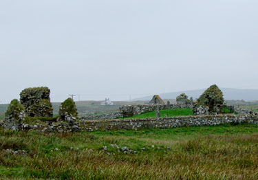
Howmore.
Ruins of the chapels and cemetery known as
Teampull Mor (the “large church”)
the east gable of which is shown at the left
of the photo above. The photo at right shows
a detail of the Caibeal Chlann 'ic Ailein,
the Chapel of Clan Ranald.
|
|
|
| |
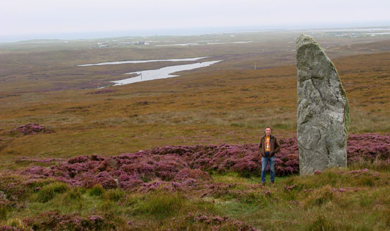
|
South
Uist. Beinn A' Charra Standing Stone |
| |
| In
recent years a number of excavations have taken place
in the Western Isles. Perhaps the most important was
that undertaken at Cladh Hallan where a number of Bronze
Age roundhouses were uncovered. Beneath the floor of
one of these were found the mummified remains of four
individuals—girl aged three, a teenage girl, and
a middle-aged man and woman. Their internal organs had
been removed and radiocarbon dating showed that they
had died some 600 years before the construction of the
house. |
| |
|
Cladh
Hallan. Roundhouses |
| |
|
The
Causeway to Eriskay |
| |
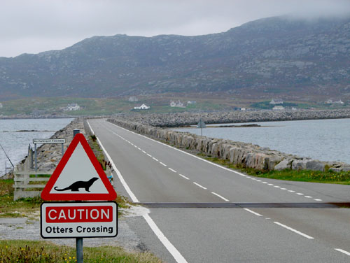
| The
last causeway of the day led to the island of Eriskay,
which is famous for two great historical events. First
of all, it is where Charles Edward Stuart, the Young
Pretender, landed in 1745 to launch his bid for the
British throne. Secondly, it is where the S.S. Politician
ran aground in 1941 with a cargo of 28,000 cases of
whisky (that's right, twenty eight thousand!)
The event was the inspiration for the movie Whisky Galore,
which was actually filmed on Barra. |
| |
September
9
The
landscape of Barra is very different from that of
the islands further north and more like the Highlands,
with more uplands and less machair. We took the ferry
across from Eriskay but there is another way of getting
there. |
| |
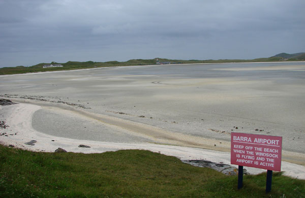
|
Barra.
The airport on Tràigh Mhor |
| |
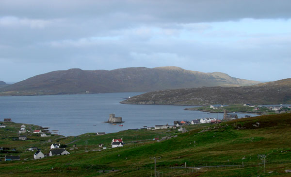
| |
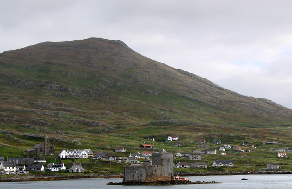
|
Castlebay
(Bagh a Chaisteil) |
| |
| The
main road around Barra is only about 12 miles (20 kilometres)
long but there is plenty to see. There are monuments
from every period of its long history— standing
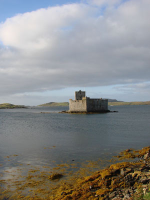
stones, brochs, wheelhouses, churches and castles. Castlebay
(appropriately) is dominated by Kisimul Castle, the
seat of the MacNeil's since the 11th century. |
| |
|
Kisimul
Castle |
| |
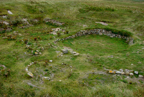
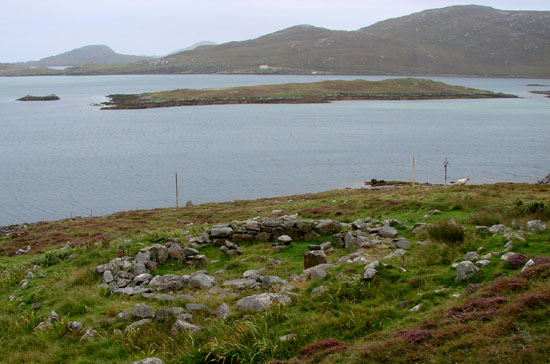
| The
site of Alt Easdal on the island of Vatersay has the
remains of a seires of buildings— a Neolithic
platform and circular houses showing evidence of a thousand
years of occupation from about 4000 BC, an Iron Age
wheelhouse dating to about 100 BC, a Norse hut from
the Middle Ages, and a blackhouse from more recent days. |
| |
|
Alt
Easdal. Iron Age wheelhouse |
| |
|
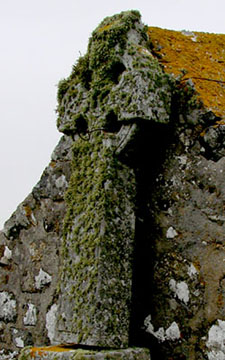
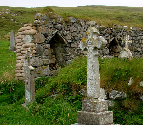
The
Chapel at Cille Bharra |
| |
| The
chapel at Cille
Bharra may date back to the origins of the Christian
community in the islands in the 7th century. No trace
of the original foundation has survived but there are
traces of an 11th century building. The ruined South
Chapel (above) was probably built around 1400. |
| |
|
Castlebay
from the Ferry |
| |