
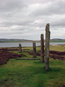
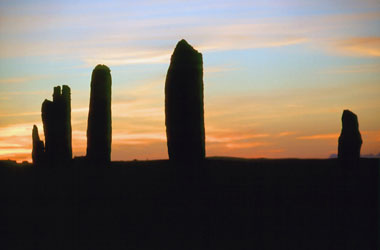
The Stone Circle with Loch Harray to the left
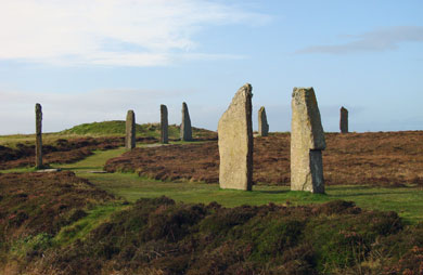
The Stone Circle
The Ring of Brodgar is located about 1.2 kilometres to the northwest of Stenness, at the opposite end of the isthmus that separates the Lochs Harray and Stenness. It too is a henge—in this case a Class II type with opposed entrances in the northwest and southeast. It is also much larger than its neighbour, measuring 123 metres from ditch to ditch, and is generally thought to have been built 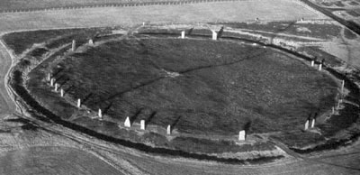 some time later. Inside and close to the ditch was a perfect circle of standing stones 103.7 metres in diameter. Unlike Stenness, the site has scarcely been excavated—Colin Renfrew put in three trenches in the early 1970’s. Two of these sectioned the ditch, which was originally about 10 metres across and as much as 3.4 metres deep. Renfrew suggests that, using fire, stone hammers and antler picks, it would have taken something like 80,000 man-hours to hack out the ditch. Two radiocarbon dates from the ditch fall in the middle of the first millennium BC—clearly much too late for the construction of the monument. Typically the material removed from the ditch would have been used to construct an external bank but Renfrew found no evidence for this. Possibly the material—and there must have been many tons of the stuff—was carted away over the years.
In the summer of 2008, further exploratory trenches were put in under the direction of Dr. Colin Richards of Manchester University 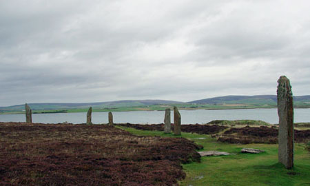 and Dr. Jane Downes of the Orkney Research Centre for Archaeology and Orkney College. Their immediate aim was to gather suitable material for new radiocarbon dates and environmental data. The results of these are pending but a summary of the seasons work and the web diary of the excavators along with plenty of photographs can be found at Orkneyjar. One thing that they noticed is that there is some variation in the width of the ditch, leading the excavator to believe that they were dug in sections, possibly by different families or villages.
There would have been 60 stones in the circle originally (if the spacing between them had been consistent) of which 27 are standing today. Many of these were lying on the ground a hundred years ago but the site was taken into state care in 1906 and they were re-erected in their original sockets. There were now 29 stones altogether but these included two that were subsequently shattered by lightning. The 2008 examination of the site included a geophysical survey 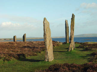 of roughly half of the circumference and found evidence for 19 stone sockets— a total of 36 altogether— suggesting that the earlier estimate of 60 was too low.
The stones enclose an area of about 0.85 hectares and, although it has yet to be excavated, a geophysical survey of the interior was unable to locate any features. However, this does not mean that internal structures did not exist. It may simply reflect the nature of the underlying bedrock and the relative lack of sophistication of earlier survey techniques. Undoubtedly, the current investigations will have much to add to the discussion.
A number of rough stone axes were found in the vicinity, along with an EBA battle-axe that had been deliberately broken, presumably as a sacrifice. Henges have always had economic associations as well as religious. Groups needed to meet periodically to exchange goods and to strengthen social links. Brodgar is nearly six times the size of Stenness and could have held hundreds rather than dozens of people.
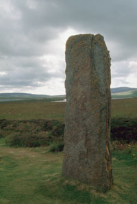
The Comet Stone
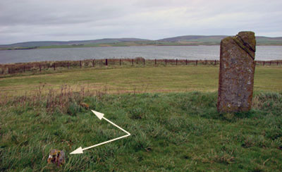 About 137 metres away to the east-southeast is a solitary monolith 1.75 metres high known as the Comet Stone. It stands at the centre of a low, circular platform about 14 metres in diameter, which also contains the stumps of another two stones (indicated by the arrows in the photograph, left). Whether these stood independently or were part of a dolmen-like structure is unclear. What is clear is that there is a nice alignment from the centre of the Ring of Brodgar, through the Comet Stone to the Stones of Stenness and Barnhouse Stone beyond.
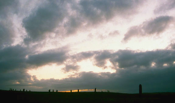
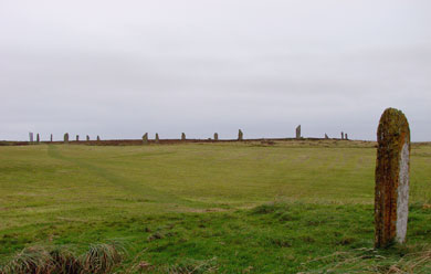
Ring of Brodgar from the Comet Stone
Further Reading
| Burl, Aubrey | (1993) | From Carnac to Callanish |
| (2000) | Stone Circles of Britain, Ireland and Brittany | |
| Cunliffe, Barry | (2001) | Facing the Ocean: The Atlantic and its Peoples |
| Garnham, Trevor | (2004) | Lines on the Landscape, Circles from the Sky |
| Renfrew, Colin | (1979) | Investigations in Orkney, Society of Antiquaries of London, Research Report No. 38 |
| Renfrew, Colin (edit.) | (1985) | The Prehistory of Orkney |
| Richards, Colin (edit.) | (2005) | Dwelling among the monuments |
| (2013) | Building the Great Stone Circles of the North | |
| Ritchie, Anna | (1996) | Orkney |
| Ritchie, J.N.G. | (1978) | ‘The Stones of Orkney,’ Proc. Soc. Antiq. Scot., 107 |
| Scarre, Chris | (2007) | The Megalithic Monuments of Britain and Ireland |
| Thom, Alexander | (1970) | Megalithic Lunar Observatories |
| Wickham-Jones, Caroline | (2006) | Between the Wind and the Water, World Heritage Orkney |